A selection of AI-driven applications delivered by JAK Services — automation, computer vision, and data pipelines for offshore and hydrographic survey operations.
The examples presented on this page were developed to support clients conducting
large-scale hydrographical survey operations.
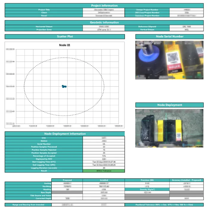
Seismic Node Report Automation
An example of a generated node report page, including plots and embedded node imagery.
For offshore seismic node deployments, reporting must be fast, consistent, and audit-ready. JAK Services built a software application that
collects the required metadata, streams real-time sensor/telemetry data during operations, and automatically compiles the final
node report in a standardized format.
What the application does
Data capture & validation: gathers all required fields (project, deployment, QC metrics) and validates them against tolerances.
Real-time streaming: ingests live sensor data while the node is being deployed/logged to reduce manual transcription and improve traceability.
One-click report generation: produces a complete report package (including plots, tables, and embedded imagery) for each node.
AI-driven image picking, categorization, and placement
A dedicated AI module selects the correct images corresponding to a given seismic node using an AI based Optical Character Recognition (OCR) module,
categorizes them (serial/QR close-up or deployment view) using an JAK Services trained AI module, and places them in the report in the right location based on the category.
Training with limited data
Having only a small number of labeled images, augmentation techniques were used to improve generalization.
This approach yielded very strong results in practice, even under challenging lighting and underwater conditions.
Technologies: Python, C#, VBA, AI
Side Scanning Sonar Image Processing Target Picking Pipeline
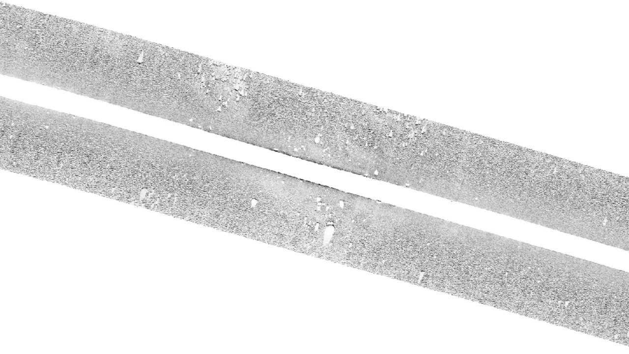
Side Scan Sonar XTF file converted into a normalized TIFF image — intensities have been equalized to produce consistent contrast — then bottom-tracked and georeferenced.
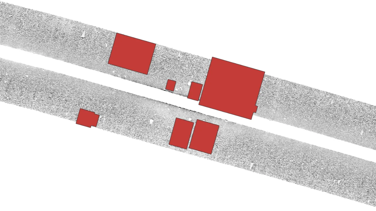
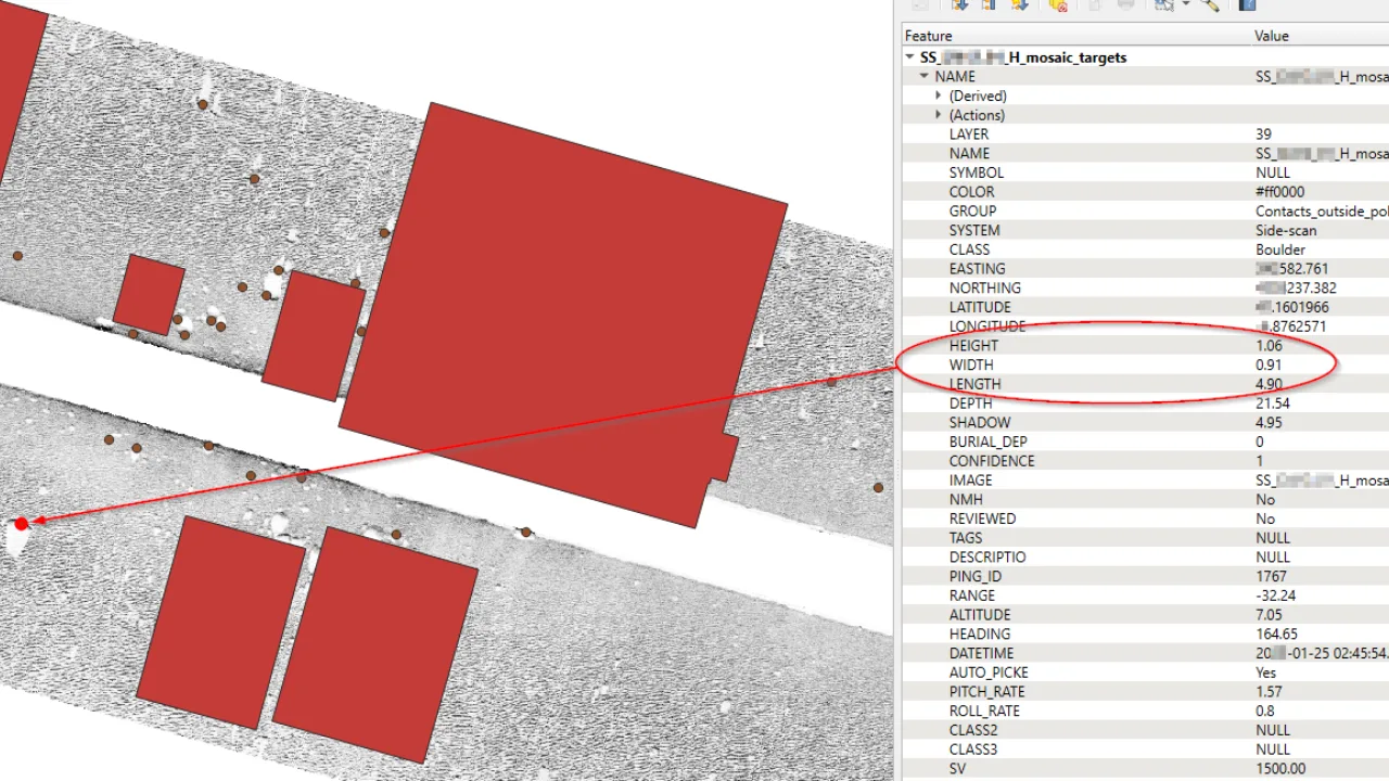
AI Detected Dense Boulder Area in a Difficult Sand Dune Area
AI Detected, Positionned And Sized Boulders in a Difficult Sand Dune Area
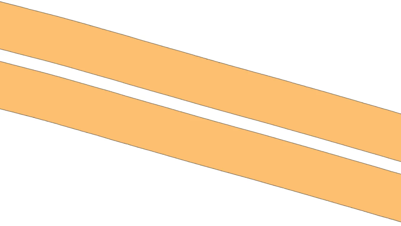
Side Scanning Sonar Coverage Polygon
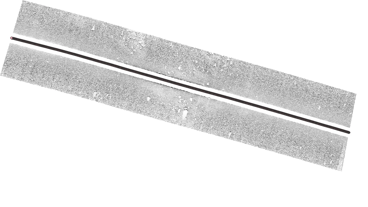
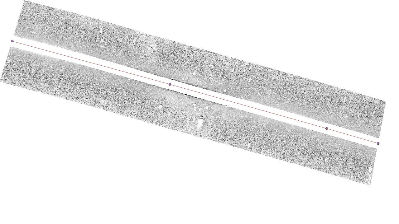
Side Scanning Sonar Track
Side Scanning Sonar Decimated Track
For a client conducting large-scale hydrographical survey operations, JAK Services designed and developed an
AI-driven Side-Scan Sonar (SSS) target-detection application.
The system processes XTF files to generate
normalized (intensity-equalized), bottom-tracked, and georeferenced TIFF images.
From these, targets are
automatically detected, sized, and categorized by an AI model, producing target lists in ESRI Shapefile format
as well as CSV files compatible with such as the Moga Software.
The application includes both a command-line interface and a batch-enabled GUI, and it additionally generates
SSS coverage data and survey tracks.
When integrated into an orchestrated near–real-time data pipeline, it
provides continuously updated GIS overview products—such as SSS mosaics, total coverage polygons with gap
detection, comprehensive target lists, and ongoing track information—throughout the progress of the
hydrographical survey.
The AI model selected and trained by JAK Services, using augmentation techniques, is a Nano-class OBB-capable
model optimized for desktop deployment (such as autonomous vessel mounted systems or office
user stations) equipped with medium- to low-spec NVIDIA GPUs.